South Asia is the southernmost part of Asia, characterized both geographically and ethnographically. According to the World Fact Book, the region encompasses Afghanistan, Bangladesh, Bhutan, India, Maldives, Nepal, South Asia, and Sri Lanka, and covers 5.2 million square kilometers (2.0 million square miles). South Asia accounts for only 3% of the world’s surface area yet accounts for 24% of the global population (Bloom & Rosenberg, 2011). The Indian Plate dominates the topography, which is mostly defined by the Indian Ocean on the south and the Himalayas, Karakoram, and Pamir Mountains on the north. South Asia is bordered on the land (clockwise) by Western Asia, Central Asia, East Asia, and Southeast Asia. South Asia has a population of about 1.891 billion people, or roughly one-fourth of the world’s population, making it the world’s most populous and densely populated geographical region. It is home to a diverse population, accounting for 39.49 % of Asia’s population and over 24 % of the world’s population.
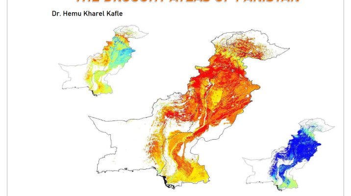
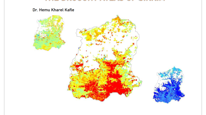
Nepal, sections of India, South Asia, and Bangladesh are among the countries studied in this atlas. The land cover type data were taken from Terra and Aqua combined MODIS MCD12Q1 data (collection v005, 500m) retrieved from Earth Data (https://earthdata.nasa.gov) for the years 2000-2020. The landcover was divided into 17 categories by the International Geosphere- Biosphere Programme (IGBP) (International Geosphere Biosphere Programme, 2017).