Building resiliency of smallholder farmers in upland farming communities in Isabela Province, Philippines
Keywords
Agroforestry · Community resilience · Shocks · Smallholder farmer · Upland community
HIGHLIGHTS
- Enhancing stakeholders’ technical capacity on Agroforestry Land Capability Assessment and Mapping Scheme (ALCAMS), a scientific method in evaluating land capability for agroforestry will facilitate appropriate agroforestry model design and establishment.
- A participatory approach in the design of agroforestry models will ensure the development of relevant and appropriate agroforestry models.
- Diversification of corn-monocropping farms through agroforestry systems can strengthen upland community resilience.
- Mainstreaming agroforestry as a component of the resilience-building agenda and development programmes of local government units (LGUs) is crucial to realise the twin goals of economic development and ecological preservation.
1. INTRODUCTION
Livelihood resilience as defined by Tanner et al. (2014) is “the capacity of all people across generations to sustain and improve their livelihood opportunities and well-being despite environmental, economic, social, and political disturbances”. The level of individual and community resiliency varies based on access to five types of capital (social, financial, human, physical and natural) based on the sustainable livelihood framework (United Nations Development Programme [UNDP)], 2017).
Smallholder farmers are facing mounting challenges due to disruption across farmers’ production systems (Bhavani & Gopinath, 2020). In terms of species diversity and ecosystem function, agricultural intensification leads to the simplification of cropping systems and landscapes (Reckling et al., 2023). High-yielding monocultures and extensive reliance on chemical pesticides and fertilisers define a greater percentage of farms at present (Hendrickson, 2015). Moreover, this vulnerable sector bears the brunt of climate change and, more recently, the global pandemic. Reduced productive capacity and obstruction to the marketing of farmers’ produce resulted in a decline in household incomes, thereby severely affecting the livelihood of vulnerable smallholder farmers (International Trade Centre [ITC], 2020; Poudel et al., 2020; Workie et al., 2020).
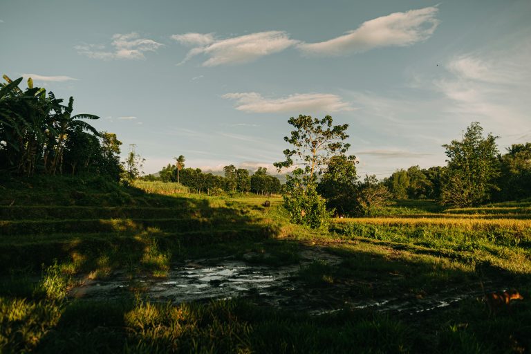
Upland farming communities in Isabela, Philippines, are continuously practising corn monoculture through the years, cultivating even the sloping areas, using Genetically Modified Organism (GMO) corn variety, applying high levels of inorganic fertilisers, and clean culture by controlling weeds using glyphosate. During corn cropping season, the upland landscape of Isabela is a picture of vast corn monoculture, in rolling and undulating terrain. This resulted in widespread soil erosion, soil depletion, loss of soil biota, and pollution of the streams and rivers with soil sediments. Being dependent on corn alone, farmers are vulnerable to the brunt of market and price intricacies and climate change, reducing their livelihood resilience.
Agroforestry, a dynamic and ecologically-based natural resources management system through the integration of trees on farms in the agricultural landscape, is a potential strategy to increase the resilience of upland farmers. It diversifies and sustains production for increased social, economic and environmental benefits for land users at all levels (Van Noordwijk et al., 2019). Farm diversification may yield better financial results than the simplified system as it helps reduce the chance of profit losses brought on by risk and disturbance (yield risk due to pest outbreak or drought or typhoon, price fluctuation, input and output market risks) (Bowman & Zilberman, 2013; Valencia et al., 2019). The global meta-analysis study by Sanchez et al. (2022) presents significant results that strongly indicate that diversified farming systems are feasible and more profitable than less diversified systems. Fostering diversification is a viable approach to ensuring socially just and environmentally responsible livelihoods resilient to global change (Valencia et al., 2019).
Studies show that agroforestry reduces the vulnerability of subsistence farmers to climate-associated hazards, contributing to a more resilient livelihood system (Pandey et al., 2016; Quandt et al., 2017; Thorlakson & Neufeldt, 2012). Meanwhile, smallholder farmers with agroforestry had higher composite scores of all indicators of resilience (financial, human, social, physical and natural capital), suggesting that they are more resilient than smallholder farmers who do not practise agroforestry (Quandt et al., 2018). However, there is a lack of information on smallholder livelihood resilience, particularly in the marginal upland areas. The basic question is, how resilient are the corn upland farming communities in the Philippines? How can we build the resiliency of these upland farming communities?
The study aims to evaluate the resiliency levels of three selected upland farming communities in Isabela Province, Philippines, based on the five capitals of the sustainable livelihood framework: social, human, financial, physical and natural capitals. This paper highlights the results of community-based projects that build resiliency in the selected upland farming corn communities in Isabela by introducing agroforestry systems. It includes a socioeconomic and resiliency level assessment of three selected upland farming communities using the Local Adaptive Capacity (LAC) and Sustainable Livelihoods Framework as a theoretical foundation. It also presents results of agroforestry introduction in the project sites by conducting land capability assessment for agroforestry, designing agroforestry systems, and establishing appropriate agroforestry systems.
2. METHODOLOGY
2.1. Project Sites
The project was conducted in Isabela province, which is considered the “corn capital of the Philippines” and has been the top corn-producing province in the country for the past 10 years (Philippine Statistics Authority [PSA], 2024). The three target municipalities were selected based on selection criteria set by a multi-stakeholder group represented by the Provincial LGU, the Department of Environment and Natural Resources – Provincial Environment and Natural Resource Office (DENR-PENRO), Isabela State University (ISU) Cabagan Campus and the Institute of Agroforestry (IAF). The criteria include: (a) representativeness to the corn farming area, (b) accessibility of the site, (c) peace and order condition in the area, (d) presence of upland farming communities with majority of smallholder farmers cultivating 2 hectares and below, (e) willingness of the LGU to actively participate in the entire project cycle, (f) presence of active farmer organisation and (g) inclusion of agroforestry development in the Comprehensive Land Use Plan (CLUP) of the LGU. The selected study sites were: Barangay DyAbra, Tumauini; Barangay Masipi East, Cabagan; and Barangay Limbauan, San Pablo.
After selecting the project areas, farmer leaders and other local stakeholders were included in the multi-stakeholder group in each project site. The formation of multi-stakeholder groups served to spearhead project implementation and facilitate activities at the project sites, including utilisation of resources, monitoring and evaluation, identification of problems and constraints in project implementation, and getting farmers’ feedback on the project. This also strengthened the stakeholders’ capacity in the participatory collaborative resilience-building project for the possible institutionalisation of the project in the area.
2.2. Data Collection
The data was gathered using mixed methods, including a household survey and focus group discussions. A household survey was conducted with a representative sample of farming households. The sampling intensity was determined using the Slovin’s formula n = N/(1+Ne2) at a 95% confidence level (Thomas, 2013). Representative corn farmers were selected using simple random sampling techniques. A household survey was administered to the selected respondents in each project site (Table 1). Focus group discussions were conducted at each site to augment the survey data gathered involving sectoral key informants.
| Study Site | Number of Respondents |
|---|---|
| Barangay Dy-Abra, Tumauini | 126 |
| Barangay Masipi East, Cabagan | 183 |
| Barangay Limbauan, San Pablo | 171 |
| Total | 480 |
2.3. Participatory Resiliency Assessment of the Upland Farming Communities
Resiliency assessment was conducted in the farming communities through a workshop involving local participants, using the LAC and Sustainable Livelihoods Framework as a theoretical foundation (UNDP, 2017). The framework utilises capital assets as indicators of livelihood resilience, which include human capital, social capital, natural capital, physical capital and financial capital. Human capital encompasses the abilities, experience, work skills and good health that, when combined, allow populations to engage with different livelihood strategies and reach their objectives. Social capital refers to the social resources individuals rely on to achieve certain objectives relating to their livelihoods, including networks and connections, and participation in formal groups. Natural capital is the stock of natural resources from which further resources and services can be developed, which may prove useful to livelihoods. In contrast, physical capital comprises the basic infrastructure and producer goods needed to support livelihoods. Financial capital refers to the financial resources that people use to achieve their livelihood objectives (Table 2).
| Capital | Indicators | Description1 |
|---|---|---|
| Social | 1. Active membership to people’s organisations (POs) | Social resources that people make use of to attain specific goals related to their livelihood (UNDP, 2017). |
| 2. Presence of immediate relatives | ||
| 3. Partnership with LGUs, development organisations and government agencies | ||
| 4. Institutional support (Training) | ||
| Human | 1. Access to health services | Encompasses the abilities, experience, knowledge, work skills, good health, and quantity and quality of the available workforce, when put collectively, enables the population to pursue diverse livelihood strategies and accomplish their goals (UNDP, 2017). |
| 2. Farming experience | ||
| 3. Knowledge in agriculture and climate change | ||
| 4. Household size | ||
| 5. Household members active in farming | ||
| Financial | 1. Household members employed | Monetary resources that individuals employ to fulfil their goals for a living (UNDP, 2017). |
| 2. Household income | ||
| 3. Varied income sources | ||
| 4. Access to market | ||
| 5. Access to credit | ||
| Natural | 1. Farm size | Natural resource stocks from which a variety of additional goods and services can be produced that could be beneficial for an individual’s livelihood (UNDP, 2017). |
| 2. Farm terrain | ||
| 3. Crop diversity | ||
| 4. Soil condition | ||
| 5. Presence of perennial crops | ||
| 6. Access to water sources (springs, rivers) | ||
| Physical | 1. Farm/land ownership | Comprises the production goods such as tools and equipment and land ownership which increases productivity (UNDP, 2017). |
| 2. Irrigation facility | ||
| 3. Farm machinery | ||
| 4. Storage facility | ||
| 5. Drying facility |
The framework used a participatory scoring method where participants were asked to give scores to each indicator included based on their importance/relevance. The corresponding weights of each indicator and variable were calculated following the Analytical Hierarchy Process (AHP), which allows users to assess the relative weights of multiple criteria or multiple options against given criteria intuitively (Saaty, 1990). The weights and scores are achieved by pairwise comparisons between all options with each other (Kazpercyzyk & Knickel, 2006). The weights of the indicators were measured vis-à-vis the household survey results to determine the current level of resilience of the three upland communities.
2.4. Policy Analysis
Policy analysis was conducted through a workshop involving the different stakeholders from the three project sites. This was done using Strengths, Weaknesses, Opportunities and Threats (SWOT) analysis on the status of the agroforestry programme and policy of LGUs and government agencies in the Province of Isabela. Based on the results of the SWOT analysis, appropriate actions and recommendations were formulated to mainstream and strengthen the agroforestry agenda in Local Government Units’ resilience-building initiatives. Future programmes at the municipal and provincial levels and possible policies to be promulgated were identified.
2.5. Assessment of Land Capability for Agroforestry Development
Prior to the establishment of agroforestry farms, assessment of land capability for agroforestry development was conducted in each of the selected project sites, using the ALCAMS, a tool that aids in determining land suitability for agroforestry. ALCAMS is based on three factors: slope (S), vegetation (V), and soil fertility (F) of a given land. Measurements on these three factors are made based on the specifications. The land is then classified according to the criteria from Class I, which is highly capable for agroforestry, to Class IV, which is not for agroforestry use (Table 3).
| Slope | Vegetation / Land Use | Soil Fertility |
|---|---|---|
| S1: 0–18% | L1: Forest | F1: High |
| S2: 18–25% | L2: Brushland/ Pasture | F2: Medium |
| S3: 25–50% | L3: Open, Cultivated | F3: Low |
| S4: > 50% | L4: Alienable and disposable | |
| Class I. | Highly capable for agroforestry | |
| Any combination with S1 + L2-L4 + F1-F3 | ||
| Class II. | Marginally capable for agroforestry | |
| Any combination with S1 + L2-L4 + F3; S2 + L2-L4 + F1-F3; S3 + L2-L4 + F1-F3 | ||
| Class III. | Conditionally capable for agroforestry | |
| Any combination with S4 + L2-L3 + F3 | ||
| Class IV. | Not for agroforestry use | |
| S4 plus L1, and/or others not included in the specification | ||
3. RESULTS AND DISCUSSION
3.1. Socioeconomic and Biophysical Characteristics of the Project Sites
Topography in the project sites is characterised as rolling in Tumauini and San Pablo, and flat to rolling in Cabagan (Table 4). The majority of the farms in the three project sites were rainfed, especially in the corn production areas. The average landholdings of the farmers ranged from 1.09 to 1.42 ha, with the largest average farm area in San Pablo, followed by Tumauini and Cabagan. The majority of the farmers in Tumauin and Cabagan were landowners, but most of the farmers in San Pablo were tenants.
| Items | Project Site | ||
|---|---|---|---|
| Barangay Dy-Abra, Tumauini |
Barangay Masipi East, Cabagan |
Barangay Limbauan, San Pablo |
|
| Sources of household income | Farming (29.36%) Farming + non-farm (70.63%) Farm labour, employment, overseas worker, construction worker |
Farming (32.79%) Farming + non-farm (67.21%) Farm labour, construction worker, overseas worker |
Farming (27.49%) Farming + non-farm (72.51%) Farm labour, vendor, overseas worker, construction worker |
| Major farm components | Corn Rice Banana |
Corn Rice Banana |
Corn Rice |
| Average farm size | 1.39 hectares | 1.09 hectares | 1.42 hectares |
| Farm ownership | Land owner Tenant |
Land owner Tenant |
Tenant Owner |
| Major source of irrigation water | Rainfall | Rainfall | Rainfall |
| Topography | Rolling | Flat to rolling | Rolling |
| Number of years in farming | 1–57 years Average: 25 |
1–60 years Average: 22 |
1–67 years Average: 20 |
| Number of family members involved in farming | 1–9 Average: 3 |
1–5 Average: 2 |
1–8 Average: 2 |
| Annual income from farming* | Php10,000.00 – P20,000.00 | < Php10,000.00 | < Php10,000.00 |
| Major farming shocks | Drought Flooding COVID-19 pandemic |
Drought Flooding COVID-19 pandemic |
Drought Flooding COVID-19 pandemic |
| * Conversion rate: 1 USD = Php 57.14 | |||
Farming is the major source of household income in the three upland communities. This is supplemented by off-farm activities, particularly farm labour on other farms. Corn (Zea mayz) and rice (Oryza sativa) were the major crops grown in San Pablo. Aside from corn and rice, banana (Musa sp.) is also commonly grown in Tumauini and Cabagan. The farmers had been farming for an average of 20-25 years, with mostly 2-3 family members involved in farming.
Farmers in Barangay Limbauan, San Pablo and Barangay Masipi East, Cabagan have a lower farm income of less than Php10,000 than those in Barangay D-Abra, Tumauini. The low farm income of farmers in San Pablo can be attributed to the limited crops produced by the farmers, which are mainly corn and rice. On the other hand, the low farm income in Cabagan can be attributed to the smaller farm production area compared to the other two sites. The farmers emphasised that their farm income alone is not enough to meet their family’s basic needs, hence they often resorted to off-farm and non-farm activities such as farm labour, employment, working overseas, vending and working in construction projects.
Being rainfed, the three farming areas are more prone to drought, which they have experienced over the past years. Aside from typhoons and droughts, they recently experienced the Covid-19 pandemic, during which the farmers experienced an unsteady supply of agricultural inputs such as seeds and fertiliser. Most of their preferred corn varieties and fertiliser (Vikings 46-0-0) were unavailable in the market, and agricultural inputs’ prices increased 2-3 times during the pandemic. In Dy-Abra, farmers experienced an increase in farm labour and transportation costs. Mobility restrictions in Masipi East were a challenge for farmers to hire farm labour during that time. On the other hand, farmers in Limbauan with no other source of off-farm income lacked the capital to hire farm labour and merely relied on family labour.
Furthermore, during the pandemic, farmers experienced low buying prices for their corn produce, from Php17.00-Php19.00/kg prior to and after the pandemic to only Php10.00/kg. The farmers were pressed to sell their corn produce even at a low price to cover their capital and input costs, which are usually borrowed from private creditors and traders. Due to the high agricultural input prices, some farmers tilled only a fraction of their farms. In contrast, others utilised a limited amount of fertiliser, which resulted in a decrease in their farm production and income. Aside from the pandemic, farmers also experienced the impacts of climate change. Most of them were aware of climate change and often associated this with stronger typhoons, more drought, more extended periods of rain, and changing climatic patterns (wet and dry seasons), which led to unstable cropping conditions.
3.2. Resiliency Level of Upland Farming Communities
The resiliency analysis results indicated that the three upland farming communities generally have low levels of resiliency (0.1569 in Masipi East, Cabagan; 0.2114 in Limbauan, San Pablo; 0.2257 in Dy-Abra, Tumauini) (Table 5).
| Project Sites | Indicators | Resiliency Indexc | |||||||||
|---|---|---|---|---|---|---|---|---|---|---|---|
| Social Capital | Human Capital | Financial Capital | Natural Capital | Physical Capital | |||||||
| Weighta | Scoreb | Weighta | Scoreb | Weighta | Scoreb | Weighta | Scoreb | Weighta | Scoreb | ||
| Barangay Dy-Abra, Tumauini | 0.0178 | 0.0185 | 0.1139 | 0.2160 | 0.3110 | 0.5333 | 0.3193 | 0.2817 | 0.2385 | 0.0791 | 0.2257 Low level |
| Barangay Masipi East, Cabagan | 0.2893 | 0.1277 | 0.0260 | 0.0346 | 0.2344 | 0.2751 | 0.3737 | 0.3263 | 0.0717 | 0.0206 | 0.1569 Low level |
| Barangay Limbauan, San Pablo | 0.0305 | 0.0051 | 0.4975 | 0.6639 | 0.2028 | 0.2568 | 0.1716 | 0.1059 | 0.0976 | 0.0254 | 0.2114 Low level |
| a Weights computed using the AHP. | |||||||||||
| b Computed using the actual data (in scale) from farmer-respondents multiplied by the weight of each sub-indicator of the five (5) resiliency indicators. | |||||||||||
| c Average of the total scores of the five (5) resiliency indicators. The resiliency index is scaled as follows: 0.00–0.33 (low); 0.34–0.66 (moderate; and 0.67–1.00 (high). | |||||||||||
Among the five capital assets, social capital has the lowest score in Limbauan, San Pablo (0.0051) and Dy-Abra, Tumauini (0.0185). According to Debertin and Goetz (2013), participation in civic groups is an important indicator of social capital. In Limbauan, San Pablo, the low level of resiliency was attributed to low membership in formal groups such as farmer organisations. This significantly hinders farmers’ access to crucial services such as credit. There was also a sparse and often unsubstantiated partnership between the farmers and the community with external organisations and a meagre institutional support in San Pablo and Tumauini, respectively. Hence, minimal assistance was extended to the farmers to include technical and capacity building assistance, particularly agriculture-related training, including agroforestry.
Physical capital assessment results revealed that Masipi East, Cabagan had the lowest score (0.0206) compared to the two other sites, which could be due to the lack of irrigation facilities limiting the productive capacity of their land. On the other hand, farmers experience post-harvest losses due to inadequate drying facilities and the unavailability of storage facilities. The result of the study by Nasrnia and Ashktorab (2021) showed a higher score of physical capital, which is associated with the degree of farmers’ access to roads and facilities of the community.
Human capital assessment results show that the lowest human capital score is still in Masipi East, Cabagan (0.0260). This can be explained by the least number of average household size and fewer household members involved in farming at this site. Han et al. (2023) highlighted that family size is positively associated with farmers’ livelihood resilience. The limited access to health services also contributed to their low resiliency level. Good health and the capacity to provide labour will enable farmers to pursue strategies and achieve positive livelihood outcomes.
In terms of natural capital, the lowest score is in Limbauan, San Pablo (0.1059), followed by Dy-Abra, Tumauini (0.2817). This can be attributed to less farm diversification, with mainly corn grown in the farms and less perennial crops in the majority of farms. According to Houben et al. (2022), a more diverse cropping system in terms of time (crop rotation with a range of crops that help maintain soil quality) and space (intercropping, agroforestry, landscape elements) promotes a more resilient system resulting from improved soil health, slower pest outbreaks, and the distribution of risks over larger areas and wider range of crops. Moreover, the low level of soil fertility in the farms and limited access to water sources directly affected crop production, thereby reducing crop yield and farm productivity. These factors contributed to the low level of resiliency of these sites.
For financial capital, Dy-Abra, Tumauini had a higher score (0.5333) than Masipi East, Cabagan (0.2751) and Limbauan, San Pablo (0.2568). Among the three sites, Dy-Abra, Tumauini had more varied sources of household income, as some household members are employed. Moreover, this site has higher income from farming, which could be attributed to more crops than Limbauan, San Pablo and a larger farm size than Masipi East, Cabagan. The low scores of financial capital in Masipi East and Limbauan can be attributed to limited access to the market for their farm produce and credit. Farmers have limited bargaining power as they are obliged to sell their produce to the traders, who provide them with capital or agricultural inputs, wherein the traders dictate prices. In addition, farmers’ access to credit is mainly from traders or private individuals with at least 5–10% monthly interest. These factors contributed to the low resiliency of these communities. The low value of financial capital (0.0218) in the study of He and Ahmed (2022) is comparable to the low scores of financial capital in Masipi East and Limbauan, which they also attribute to limited access to credit opportunities.
The findings suggest that building the resilience of the three upland farming communities requires a balanced and holistic approach that takes into account the present state of five resilience indicators.
3.3. Appropriate Agroforestry Design and Establishment
Three (3) farms were selected by the multi-stakeholders to establish an appropriate agroforestry model farm based on the criteria set by the multi-stakeholders in the project sites. ALCAMS was conducted in these areas to assess the capability of the land for agroforestry development, based on slope (S), vegetation (L) and soil fertility (F) in the selected areas, and classified based on agroforestry land capability. Results showed that the three project sites belong to class II or marginally capable for agroforestry (Table 6) with the combination of S1/S2/S3 (0–50% slope) + L3 (open, cultivated land use) + F3 (low soil fertility). Based on the ALCAMS findings and the farmer-cooperators’ preferences, an acceptable and appropriate agroforestry model design was developed and established in a participatory manner for each project site. For a more acceptable system, corn-based agroforestry model farms were designed and established in the three sites. The monocropping farms were diversified and integrated with perennial components such as hybrid coconut (Cocos nucifera) and calamansi (Citrus x macrocarpa). In sloping areas within the farm, hedgerows were established using madre de cacao (Gliricidia sepium) as a soil and water conservation measure.
| Factors | Agroforestry Model Farm | ||
|---|---|---|---|
| Barangay Dy-Abra,
Tumauini |
Barangay Masipi East, Cabagan |
Barangay Limbauan,
San Pablo |
|
| Slope | 10–20 (S2) | 0–33 (S3) | 15 (S1) |
| Vegetation | Cultivated (L3) | Cultivated (L3) | Cultivated (L3) |
| Soil fertility | Low (F3) | Low (F3) | Low (F3) |
| pH | 4.0 | 4.6 | 4.3 |
| OM (%) | 3.46 | 3.53 | 3.48 |
| P (mg/kg) | 4.5 | 9.4 | 2.7 |
| K (cmol/kg soil) | 0.19 | 0.45 | 0.59 |
| Soil textural class | Sandy clay loam | Sandy clay loam | Sandy clay |
| Classification | Class II – Marginally capable for agroforestry (S2, L3, F3) |
Class II – Marginally capable for agroforestry (S3, L3, F3) |
Class II – Marginally capable for agroforestry (S1, L3, F3) |
| Agroforestry systems established | Corn-based agroforestry system. Corn integrated with hybrid coconut, banana and madre de cacao along the boundary |
Corn-based agroforestry system. Corn integrated with hybrid coconut and calamansi with hedgerows in sloping areas |
Corn-based agroforestry system. Corn integrated with a hybrid coconut |
3.4. Policy Analysis and Implications
Using SWOT analysis, the multi-stakeholders analysed the current status of the agroforestry programme and related policies of Local Government Units and government agencies.
One of the challenges raised during the policy analysis workshop was the unclear inclusion of agroforestry development in the agenda of LGUs. Although in the CLUP of the three municipalities, certain areas are designated for agroforestry (Table 7), they lacked the technical, manpower and financial capacity to implement the agroforestry programmes. It was unclear which office within the Municipal LGUs should carry out the agroforestry agenda. Thus, it is recommended to institute local policies through resolution or ordinance: (a) allocate funds from the LGU for the implementation of agroforestry projects/programmes together with the DENR and other organisations in upland farming communities; (b) designate an office with technical staff within the Municipal LGU that will spearhead the implementation of the agroforestry programme/agenda; (c) harmonise agroforestry programmes/projects within various levels of LGUs from provincial down to barangay level; (d) train core farmers and LGU technicians who will proactively take the lead in promoting agroforestry systems in their respective areas; and (e) integrate ALCAMS as a tool in the appropriate design and development of agroforestry farms in upland farming communities, especially in areas designated for agroforestry development in the respective LGU’s CLUPs.
| Strengths (S) | Weakness (W) | Opportunities (O) | Threats (T) |
|---|---|---|---|
| ∙ Presence of organised farmer organisations to implement agroforestry programmes and projects
∙ Availability of resources by Provincial LGUs and DENR to support agroforestry projects ∙ Existing areas for agroforestry development in municipal LGUs CLUPs |
∙ Low membership and inadequate organisational capacity of farmer organisations to link up with external agencies and institutions
∙ Limited agroforestry and agriculture-related trainings and opportunities for farmer organisation members ∙ Delayed release of funds from government agencies ∙ Lack of technical expertise of municipal LGU staff to implement agroforestry programmes and projects ∙ Manpower scarcity from DENR and LGUs to implement and monitor agroforestry programmes and projects ∙ Insufficient funds of Municipal LGUs ∙ Office within the municipal LGU to implement agroforestry initiatives in areas not clearly defined or assigned |
∙ Potential project proposal funding for qualified farmer organisations
∙ Potential support from DENR for capability building, such as training on agroforestry ∙ Collaboration between government agencies, such as DENR and LGUs, for agroforestry initiatives |
∙ Ineffective and inefficient implementation of agroforestry projects and initiatives
∙ Non-adoption of agroforestry systems |
4. CONCLUSION
The result of the socioeconomic and biophysical assessment suggests the need to enhance the farming systems in these three upland farming communities. The low level of resiliency of the three selected upland farming communities requires a balanced and holistic approach to improve their capital assets for sustainable livelihood. Farmer organisations should be strengthened and capacitated, and linkages and partnerships should be established with government agencies and development organisations for external support to enhance their social capital. Physical capital can be augmented through the provision of adequate irrigation systems and post-harvest facilities to increase farm productivity and minimise farm losses. To address the dwindling household members who farm, especially the younger generation, agriculture-related and agroforestry training should be conducted to encourage youth in order to reinforce the human capital of the farming communities. Natural capital can be revitalised with farm diversification through agroforestry. Moreover, soil and water conservation support technologies are imperative to control soil erosion and improve soil fertility and water availability, especially in sloping farms for sustained farm productivity. Boosting financial capital through the integration of appropriate woody perennial crops in the corn monocropping production areas in these upland farming communities is imperative to improve farm income.
Appropriate agroforestry models can be designed and established in areas designated for agroforestry development in the respective CLUPs of the Local Government Units using a participatory approach and scientific method through ALCAMS. Furthermore, agroforestry should be incorporated into the resilience-building agenda of the LGUs with adequate funding support to realise the full economic and ecological benefits of agroforestry systems in upland farming systems in the country.
5. ACKNOWLEDGEMENT
The project team extends its sincere gratitude to the Asia-Pacific Network for Global Change Research (APN) for providing funding support under project reference CBA2021-01MY-Ocampo. We also wish to acknowledge the Provincial Government of Isabela, the Municipal Governments and farmer organisations of Tumauini, Cabagan and San Pablo, as well as the Department of Environment and Natural Resources (DENR) and the Philippine Coconut Authority (PCA), for their invaluable support and assistance throughout the project.